


Departure from Porto
cruise port - ruler
10 hour program
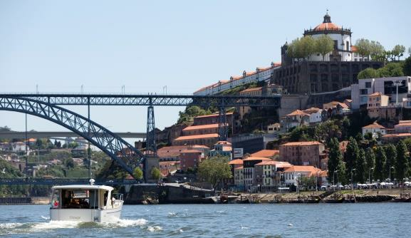
Between the Atlantic Ocean and Spain, the rise of the Douro reveals an enormous variety of landscapes and tones, revealing a close connection between the original geography of the region and the work of Man.
08:30: Board at Douro Marina and leave for Régua
10:20 am: Passage through the Crestuma lock
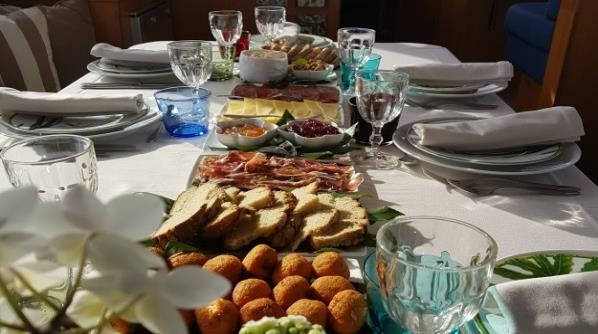
12:30 pm: Stop for lunch at a local restaurant
3pm: Continuation of the journey to Régua
3:50 pm: Passage through the Carrapatelo lock
6:30 pm: Arrival in Régua

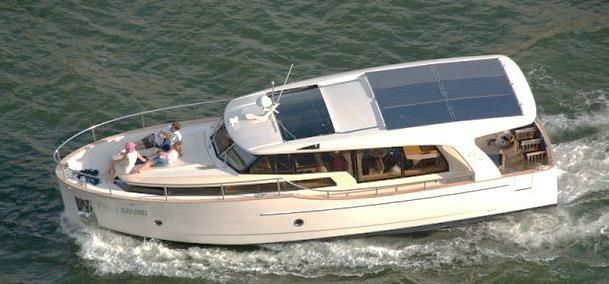
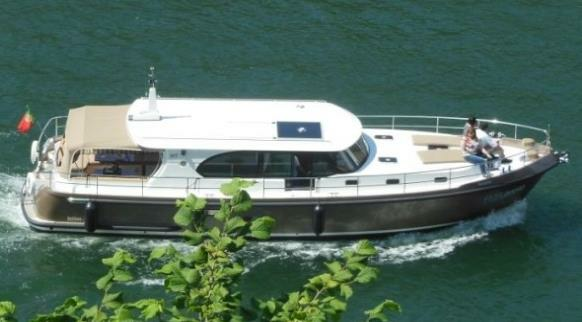
12 meters
Capacity: 12 people
price per boat
2.200 €
14 meters
Capacity: 12 people
price per boat
2.340 €
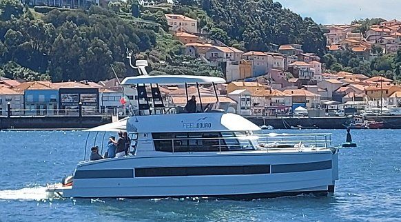
Catamaran
Capacity: 18 people
price per boat
2.500 €
Includes:
- Exclusive tour;
- Fuel;
- Safe
- Crew
- IVA
Does not include:
- Accommodation;
- Food;
- Visit museums;
- Visit to country houses;
- Night navigation fee of €100
Note: The times and places to be visited may change depending on the time of year
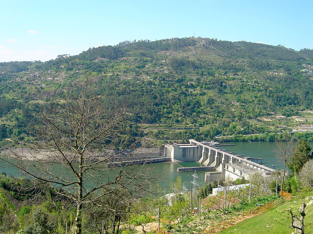
CARRAPATELO DAM
The Carrapatelo Dam is located on the Douro River, on the border of the districts of Porto and Viseu, respectively in the municipalities of Marco de Canaveses and Cinfães, in Portugal.
The construction of the Carrapatelo Dam began in 1965 and ended in 1972. Inaugurated on June 18, 1972 by the then president of the republic, Admiral Américo Thomaz, it was the first hydroelectric project to be built on the national stretch of the Douro River and is, of the five uses of the Douro Nacional, the one with the greatest fall, 36m.
It is a Gravity type dam, lightened by means of a large circular gallery next to the foundation. The main spillway is located on the concrete area, controlled by 6 large segment gates, with a span of 26m and a height of 15.4 m, anchored by powerful prestressed cables to the concrete pillars and is designed for a maximum flow of 22,000 m³. The dam has a height of 57 m and a crown length of 400 m.
The total area of the river basin is 92,050 km² and extends for 40 km, reaching the Régua hydroelectric plant at the upstream end. The retention level was planned to take into account flooding problems and, in particular, to avoid interference with the Douro Railway.
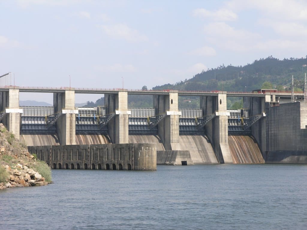
It also has a navigation lock, which was the first to be built in Portugal for inland navigation. Together with the locks for the Pocinho, Valeira and Régua (upstream) and Crestuma-Lever (downstream) hydroelectric plants, it allows the Douro River to be transformed into a waterway with international characteristics. Its dimensions, 12.1 m wide and 85 m in useful length, guarantee the passage of boats with a maximum capacity of around 1,500 tons.
It also has a fish lock, integrated into the thickness of the central dam wall and is essentially composed of a lower fishing chamber with 3 entrances, an inclined gallery and an upper chamber. From this chamber, already in the open sky, there is a channel through which the fish go to the reservoir, not without passing through the fish counter installed there between two observation windows.
RULER WEIGHT
ORIGIN OF THE NAME
The origin of the name Peso da Régua is surrounded by uncertainty. Inhabited by Roman and barbarian invasions during the first part of history, its name may have arisen from several sources. (1) from the name Vila Reggula, a Roman farm that once existed near the historic center. (2) from the word récua (the ships that sailed the waters along the Douro); or derived from the word reguengo (a designation for lands that were attributed to the monarchy).(3) Peso da Régua may also have its origin in the word rule, alluding to the hereditary rights of descendants achieved through charters. It is likely that this rule gave rise to the word Régoa, and later Régua.
Concerning the first word, Peso, there are two opinions about its origin: (1) that it was derived from the place where goods were weighed, or where taxes were collected; (2) that the word was probably used to define the place where animals were weighed.
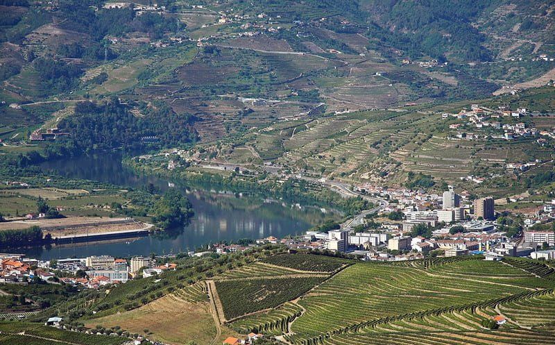
Photo: Vitor Oliveira – Portuguese_eyes
Located next to the Douro River, this location played a leading role in the production and marketing of Port Wine, as it was from here that barrels of wine were transported on rabelo boats to Vila Nova de Gaia, where the wine aged in the cellars.
Peso da Régua is the perfect destination for those who appreciate good wines and wine culture. It is located in one of the most beautiful regions of Portugal, the Douro Valley, an area declared a UNESCO World Heritage Site.
In this region, the vineyards grown on terraces on the slopes next to the river offer beautiful panoramas that can be admired from the many viewpoints in the area, including São Leonardo in Galafura and Santo António do Loureiro.
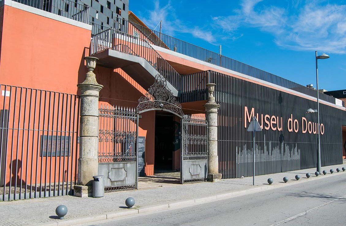
In the city, there is the Douro Museum that allows you to learn about the history of the drink and the place.
WHEN: It is a destination to visit throughout the year. Visits and tastings to wineries take place in any season. What changes in each season are the colors of the landscape and some activities.
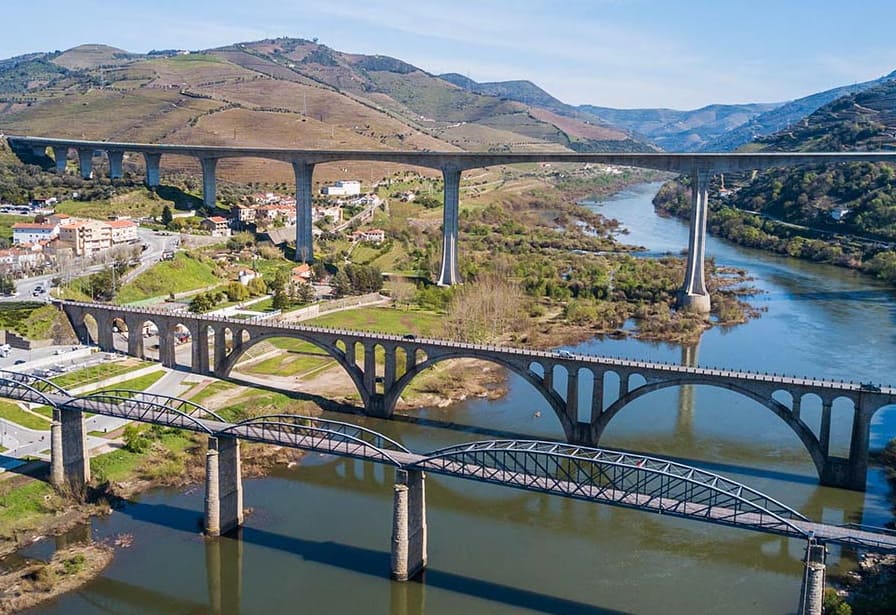
Three imposing bridges cross the Douro River and stand out in the city's landscape.
The Miguel Torga Bridge is the largest. It was opened in 1997, is 90 m high and 900 m long.
Ponte da Régua, built in 1934, is part of the N2 road. It is formed by three larger and smaller arches and is around 350 m long.
The old railway bridge, transformed into the Régua Pedestrian Bridge, exclusively for pedestrians.
SOME HIGHLIGHTS:
Source: Douro Museum
Douro Museum
Created in 1997, the Douro Museum is located in the former premises of the Real Companhia Velha. The museum offers a collection closely linked to the local wine culture, such as boats, objects, documents, panels, among others.
In the space you can also find a store, a restaurant and a wine bar with views of the Douro. It normally operates from 10am to 6pm.
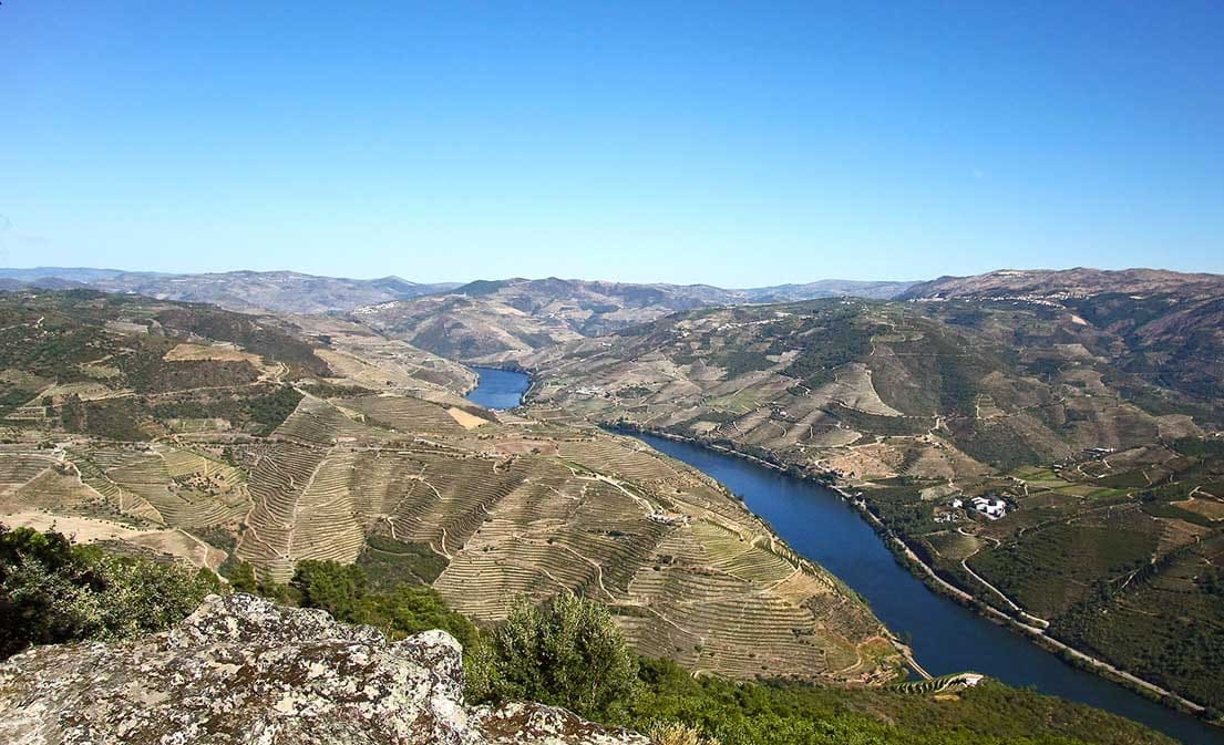
Photo: Vitor Oliveira – Portuguese_eyes
Viewpoint of São Leonardo da Galafura
Despite the immense viewpoints and places with incredible views between the wineries, with magnificent and stunning views, this viewpoint stands out for its high altitude in relation to the valley. Located near Covelinhas, between Vila Real and Peso da Régua, it offers views at an altitude of 640 m.
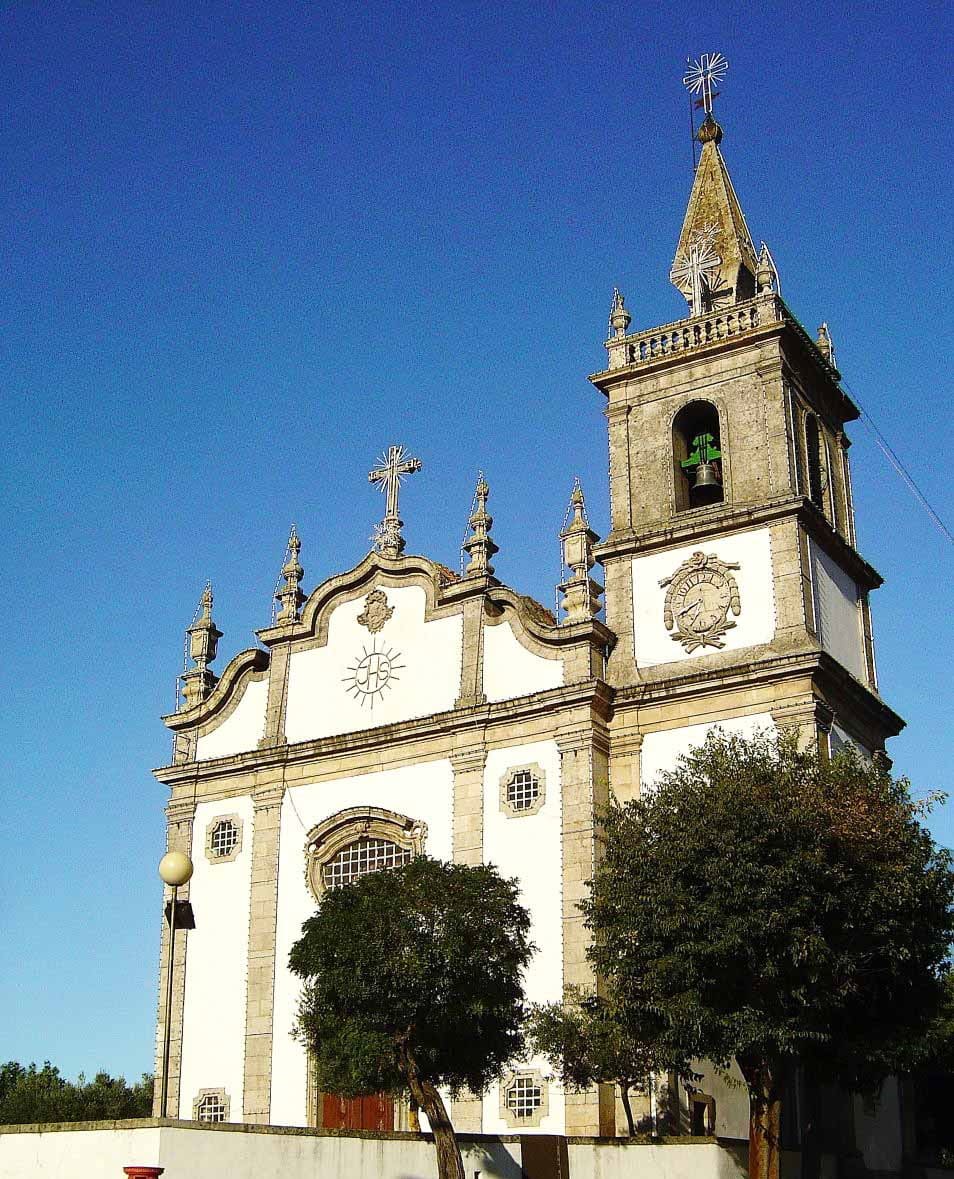
Photo: Vitor Oliveira – Portuguese_eyes
Parish Church of Peso da Régua
This church dates back to 1737. With a small square in front and a bandstand, inside there are gilded ornaments and a panel by Pedro Alexandrino de Carvalho with a painting of the Last Supper.
For more information, fill in the details below and we will contact you.